

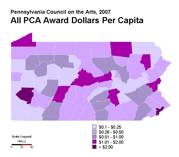
In this example, the agency’s grantmaking dollars and U.S. Census population data are layered together, providing a more information-rich picture.
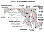
This example shows the names and locations of the state arts agency’s regranting partners, the county arts councils.
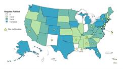
NASAA also uses maps to document its own work. This example shows the distribution of member information requests fulfilled, as well as in-person staff site visits that were conducted over the past year.
For more information, or to request your own maps, contact Angela Han.